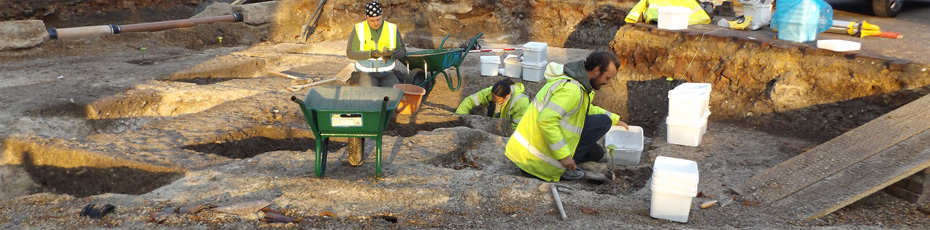
KDK Archaeology Projects
A few examples of some of the projects we have undertaken. More can be found on our Gallery page
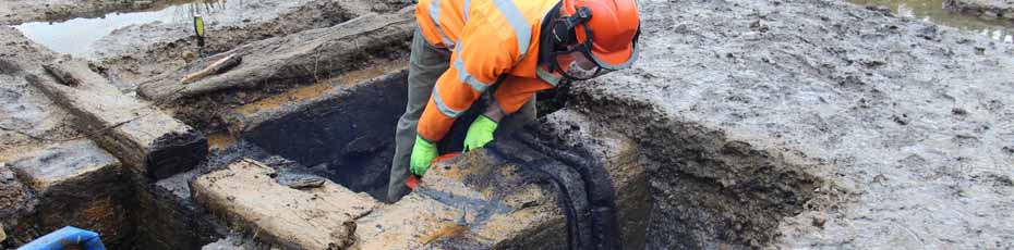
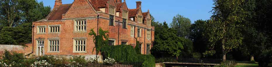
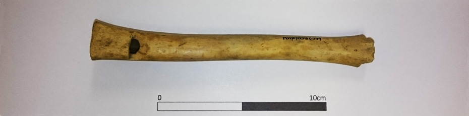
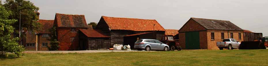
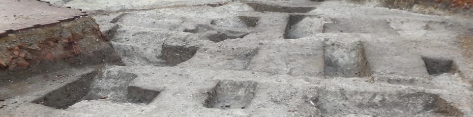
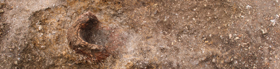
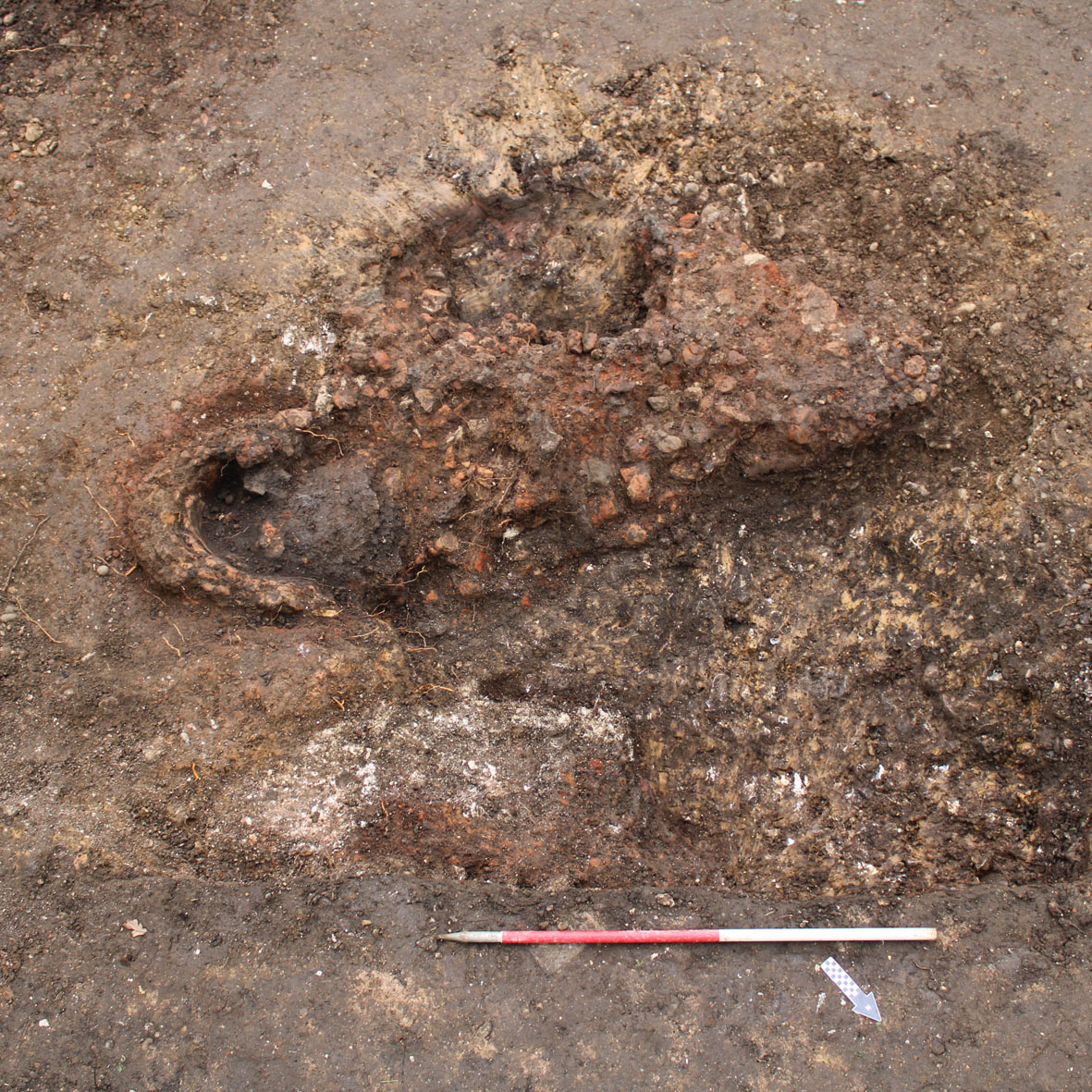
Ridgeway, BerKhamsted, Hertfordshire
Visitors to this website from Berkhamsted may be familiar with their local prehistoric feature, Grim's Ditch, which is situated on the southwest ridge of the valley. This once extensive earthwork probably dates from the Iron Age and is known under several names including 'Grim's Dyke' and 'Grim's Bank'.
In late 2021, KDK carried out a small Watching Brief on an extension to a house on The Ridgeway. Beneath the old patio were the remains of a tower furnace, probably dating to the late Iron Age or early Roman period. The main pit in which the furnace was located contained the remnant base, the remains of the collapsed tower flue, around 16kg of iron slag and some pottery.
The post-excavation work is ongoing with a view to confirming the date of the structure and investigating other issues related to local archaeological research aims.
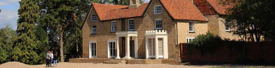
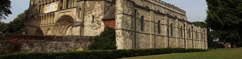
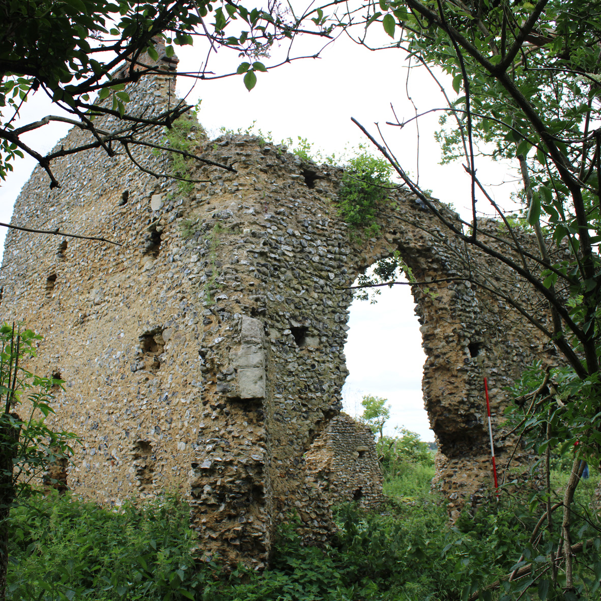
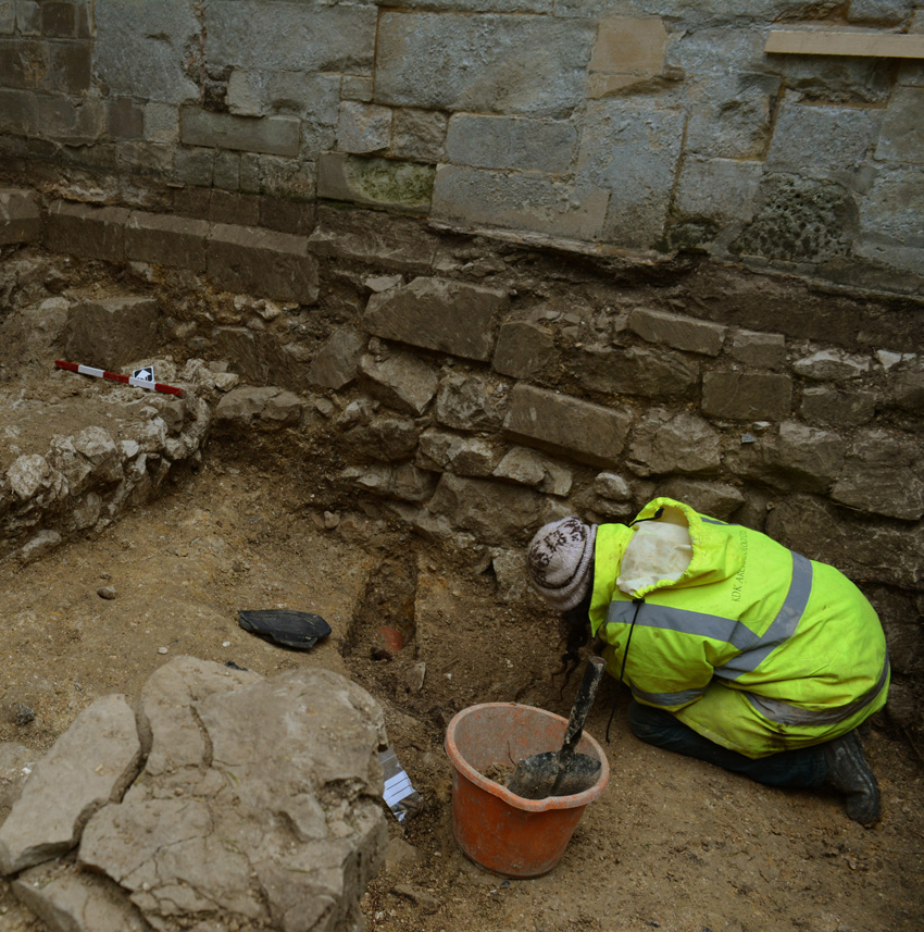
Minsden Chapel, Langley, Hertfordshire
In June 2021 KDK Archaeology Ltd carried out Historic Building Recording of Minsden Chapel, Langley, Hertfordshire as part of a Management Plan for the consolidation of the ruins and the management of associated trees and shrubs to protect the remains.
Minsden Chapel, which is both a Scheduled Monument and a Grade II Listed Building, dates from the 14th century and, given the mention of a priest serving Minsden in the Domesday Book, may have replaced an earlier church. Regular Divine Service appears to have ceased by the mid 17th century, but the chapel still played a significant role in the community in the early 18th century, by providing a place of worship for a large congregation of non-Conformists. The last known service was a wedding between Enoch West and Mary Horn on July 11th 1738 when a piece of masonry fell onto the service book being held by the curate.
The building has been systematically looted with the font and bells amongst the first losses. Tracery, stained glass windows and building materials were sold at auction or on the market in Hitchin in the 19th century. The chancel arch collapsed as recently as the early 2000s and general decay and vandalism have left the remaining walls extremely vulnerable.
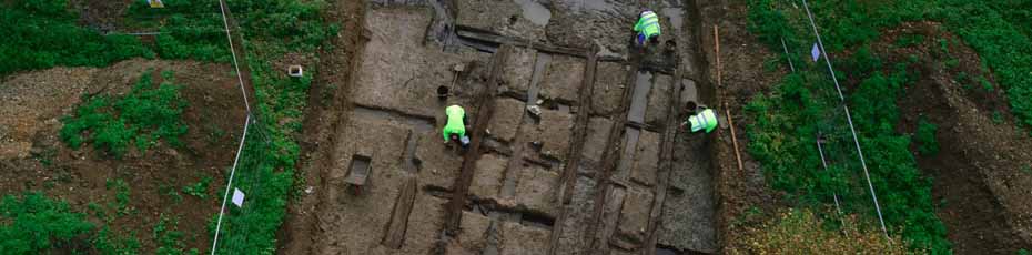
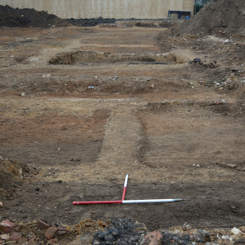
Realignment of A602 Ware Road, Watton-At-Stone, Hertfordshire
The realignment of A602 required the construction of 2.4km of new road alongside the existing Ware Road. Geophysics and subsequent trial trenching had picked up some archaeological features, so a Strip, Map and Sample planning condition was attached to the development.
Clusters of activity were present near the central and southeast end of the site. The earliest features encountered comprised un-urned cremations, four of which were dated to the Bronze Age. A further later Roman inhumation was also recorded, located on the crest of the hill northwest of Sacombe Pound. This burial consisted of an adult male who appears to have been interred with little or no ceremony, squashed into a narrow, shallow ditch, with no discernible grave cut.
To the southeast of the site at Stonyhills, on the next hill top, evidence for mid-late Iron Age settlement was recorded in the form of a penannular drip gully with a southeast facing entranceway; the remnants of a roundhouse.
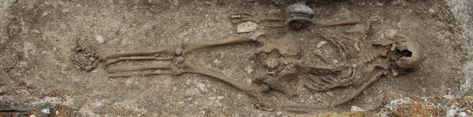
Church of St Nicholas, Rectory Lane, Stevenage, Hertfordshire
KDK Archaeology Ltd undertook a programme of Observation and Recording of St Nicholas, Rectory Lane, Stevenage, Hertfordshire as part of the reconfiguration of the church interior. The church is Grade I listed and dates from c.1125. Extensive alterations were undertaken in the 1840s and again in the early 20th century, which along with the medieval enlargement of the aisles and chancel, resulted in the relocation of a number of burials and ledger slabs. In total 22 individual burials were observed during the ground reduction, and 10 groups of disarticulated remains were revealed, predominantly in the south transept, which was added in 1841 and the north and south aisles. At least two of the burials are of former rectors, one of which was revealed beneath the oldest ledger slab in the church dating from the very early 14th century and thought to be Gerald de Stanton (d.1314). One individual, whose skull was discovered behind the altar, had suffered severe head wounds, whilst another had a remarkable set of well-kept teeth.
Five burial chambers were partially exposed, two of which were not directly beneath ledger slabs as they had been moved during one of the earlier building programmes. A row of vaults beneath the line of ledger slabs in the north aisle had previously remained undisturbed, and a stair access was revealed at the western end during the current building programme. This was cleared and became the repository for the remains that had to be relocated.
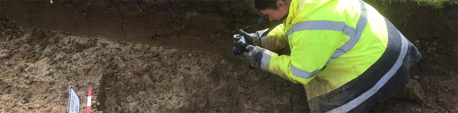
Shefford Lower School, Shefford, Central Bedfordshire
On the OS 1st edition map, at the site of Shefford Lower School, is marked “Roman Temple”. The site had been partly excavated when the school was first built and the results interpreted as a Roman ritual site. A previous evaluation had identified significant features in some of the trenches, so prior to the construction of housing, a Strip, Map and Sample excavation was carried out. In amongst the footings of the old school were the remnants of Roman walls, some covered by the backfill of the original dig. However, they were more extensive than the footprint of that investigation and appear to be the remains of a high-status Roman dwelling. There were few cut features in the relatively small area covered, though there was a substantial ditch running north-south which contained the remains of a probably dumped horse.
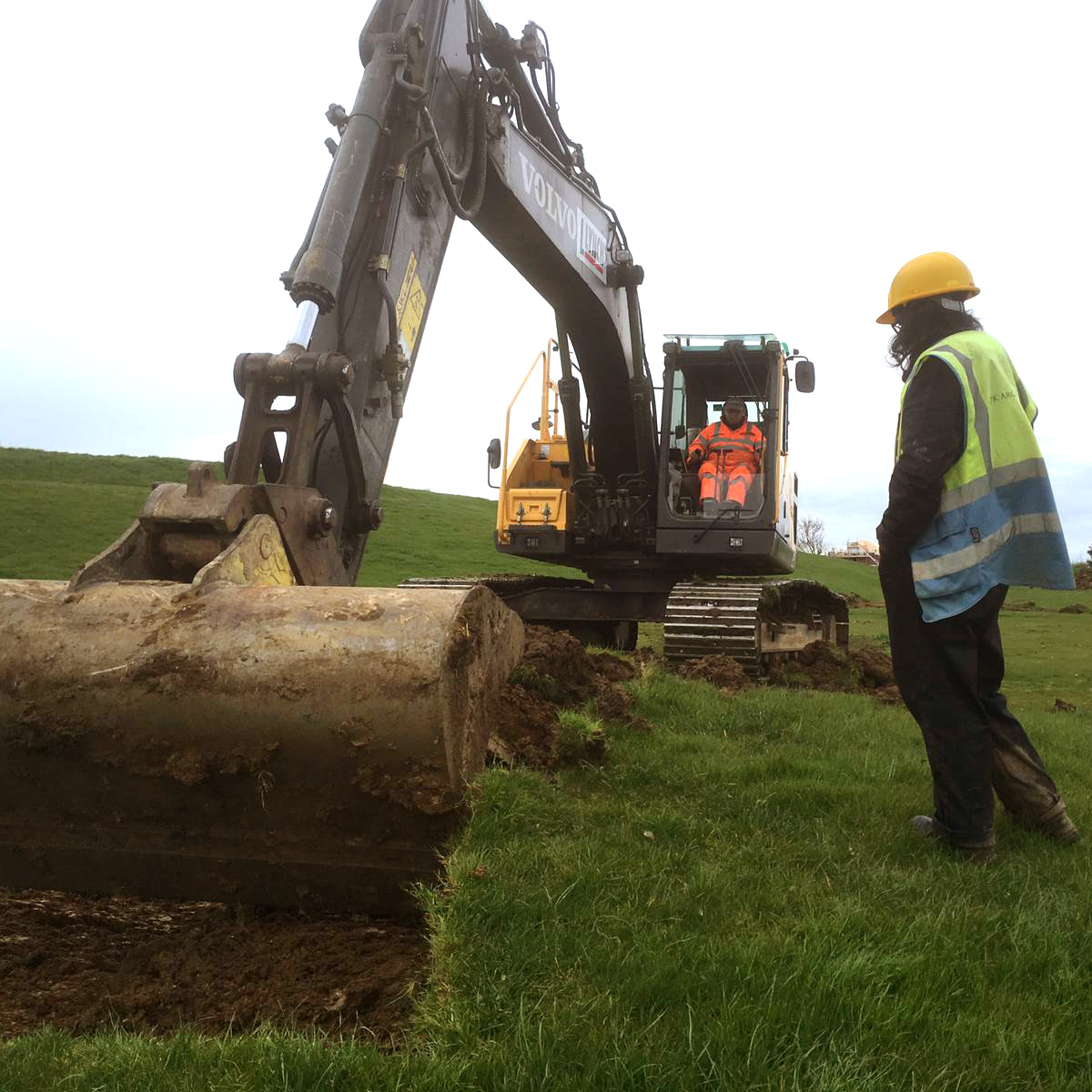
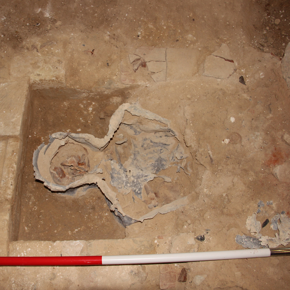
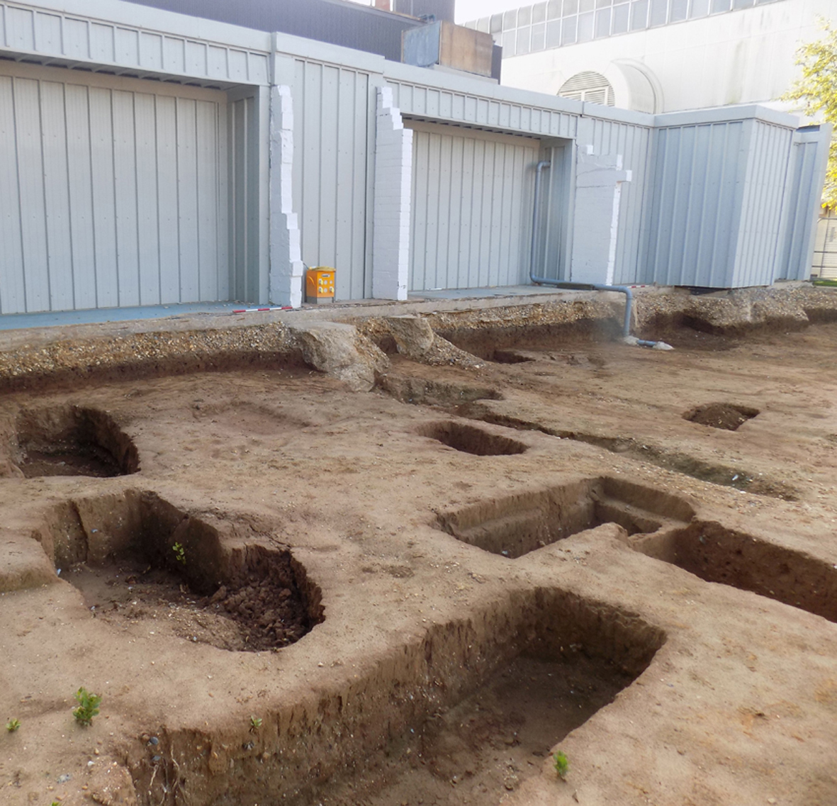
Castle Moat Road, Huntingdon, Cambridgeshire
An Open Area Excavation on the site of the Former Red Cross Centre, Castle Moat Road, Huntingdon Cambridgeshire was carried out as a condition for the planning permission for the development of the site.
During this investigation a total of 108 cut features were investigated including 28 linears, 28 postholes/post pads, 3 stakeholes, 4 construction cuts and 48 pits. Six structures believed to be furnaces for metal working were exposed as were multiple layers and deposits associated with industrial and occupational activity. Some of the larger layers on the site consisted of redeposited natural gravels and sands which were probably a by-product of local quarrying in the area. Roman features were cut in to these layers and Roman and possibly earlier features lay beneath them. An articulated but disturbed human infant burial and several large fragments of disarticulated skull from an adult individual were also identified. Many of the features were rich in datable material, providing evidence for a sustained activity on the site.
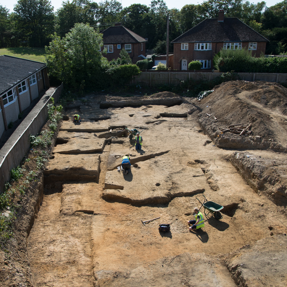
The Wavendon GolF Centre, Wavendon, Milton Keynes
KDK Archaeology Ltd undertook a 42 50m trench Archaeological Evaluation at Wavendon Golf Centre, Lower End Road, Wavendon, Milton Keynes, prior to the construction of a new housing development of up to 400 new homes with landscaping, and supporting infrastructure. The evaluation documented settlement activity dating from the mid/late Iron Age and Romano-British period in the form of ditches, gullies, pits, postholes, ceramics, and animal bone, with the potential existence of relatively high-status structures in a rural environment. The Iron Age activity was concentrated in one area of the site and may represent a phased enclosure similar to one previously excavated to the north. Later activity comprised medieval ridge and furrow, and post-medieval to modern land-drainage and management.
The old palace lodge hotel, dunstable, Central bedfordshire
Previous work carried out at the Old Palace Lodge Hotel had identified the potential for archaeological remains to be present within the footprint of a proposed extension to the hotel. The area was subject to a Strip, Map and Sample excavation which revealed a surprisingly high density of archaeological features, including several ditches, a pit complex and a solitary burial. Initial analysis of the skeleton suggests she was an older woman who was buried in a prone (face down) position, but she was also interred with a small pot by her left hand. The contents of the pot have been recovered and will be analysed in due course. The pottery from the site indicates that it was in use during the late first to mid second century, and possibly earlier. The location of the features is towards the eastern limit of the known Roman archaeology in Dunstable, though more work is proposed on the site which may help to confirm this.
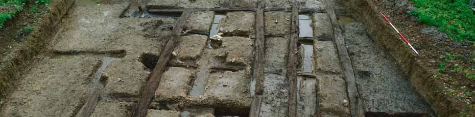
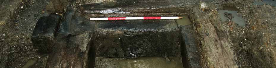
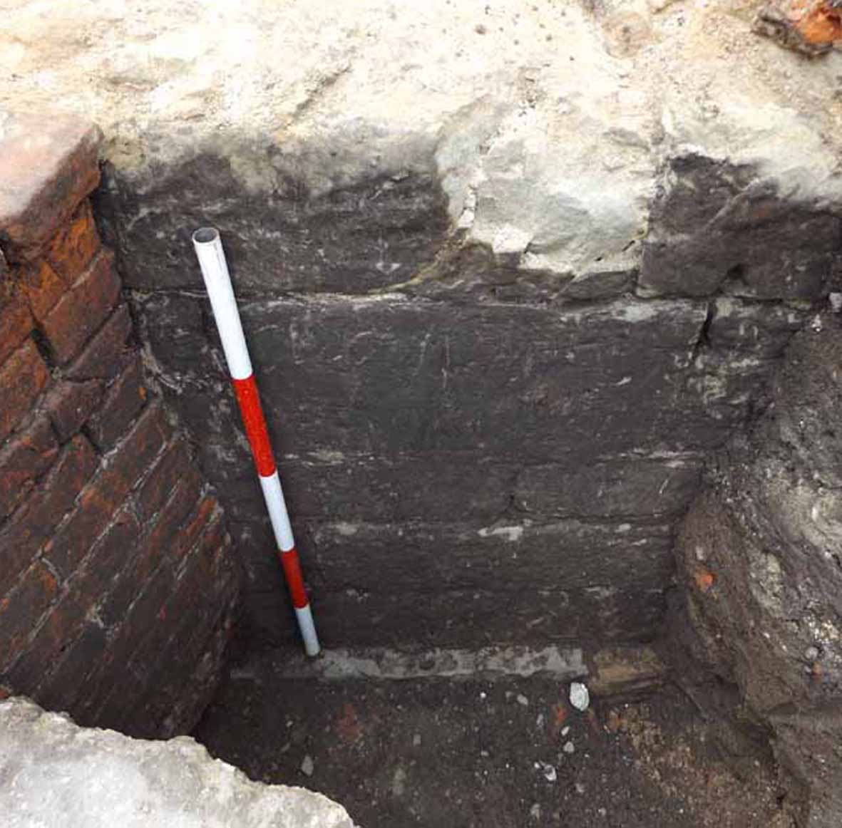
The Lock keeper's cottage island, GSK, ware, hertfordshire

Prior to the installation of a mini hydro-electric turbine by GlaxoSmithKline in Ware, KDK undertook a programme of archaeological trial trenching across the Lock Keeper's Cottage Island. Well preserved timbers were present in one of the trenches, which resulted in further investigation through geophysics, open area excavation and a programme of geo-archaeological bore hole testing. The excavation exposed a timber caissoned bridge abutment or quayside, and the core sampling revealed a probable gravel surface over 40m in length, and the northern edge of the Roman river channel. Subsequent carbon dating of the timbers and analysis of pottery from a layer immediately overlying the gravel suggested the structure was probably built in the early second century. This ties-in well with other excavations at GSK which have demonstrated that activity at the Roman settlement there peaked in the mid second to mid third century. The publication report text will be submitted soon and will hopefully appear in a forthcoming edition of Britannia.
-
RSPB Reserve, Sandy, Central Bedfordshire
-
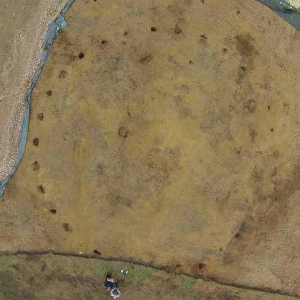
- In advance of the installation of a wind turbine at the RSPB Reserve in Sandy, Central Bedfordshire, KDK monitored 1.2km of cable trenching and carried out a Strip, Map and Record excavation of the turbine base, access road and contractors' compound. A probable Iron Age round house was exposed, consisting of more than 20 post holes in a 16m diameter circle with a clearly visible central hearth. A smaller later enclosure was also recorded along with a wide, shallow ditch, a gully and a pit. Unfortunately, a few of the post holes had been destroyed by rabbits burrowing into the loose sandy natural geology, and the size and position of the compound meant that not all of the post holes were exposed. However, the work that KDK undertook resulted in the recording of a significant feature within this prehistoric landscape. The publication report will be available in due course.
-
-
The Lord Leycester Hotel, Warwick
-
- Prior to the redevelopment of the Lord Leycester Hotel in Warwick, KDK carried out a programme of trial trenching in the car park. Previous geophysics had identified the presence of possible structural features, and the trenches were targeted to help resolve some of the questions raised from that data. The principal feature exposed was a wall of dressed limestone at least a meter in height. It coincided with the geophysics plot and therefore it is likely to extend across the whole site. The hotel is situated in the centre of Warwick, adjacent to St Mary's church, which was founded on the site in 1123, and whilst no definitive dating of the wall was possible, it is made of the same stone, and constructed in the same way as some of the known medieval structures in the immediate location.
-
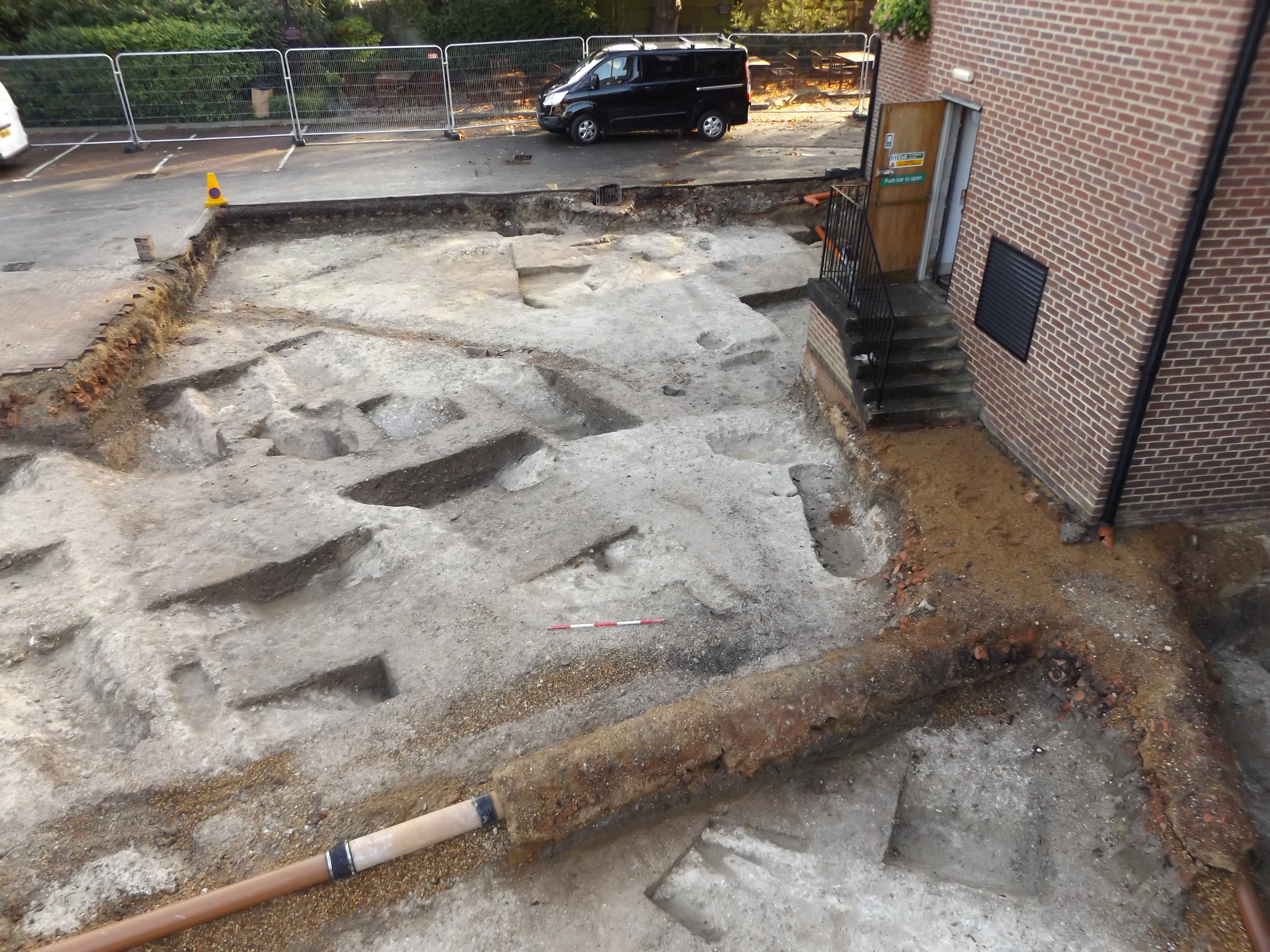
P5 Building, GSK, Ware, Hertfordshire
-
- As part of on-going redevelopment of the GlaxoSmithKline complex in Ware, buildings on the northern edge of the site, that are no longer fit for purpose, are being demolished to make way for modern facilities. As Roman Ermine Street transects the site there is a considerable amount of archaeology present, in some areas.
The first phase was the demolition of the western half of the building. KDK carried out an open area excavation over the summer of 2015, of the late Roman cemetery site that lay beneath. At least 26 graves were identified, with 22 containing human remains. All of the burials were supine, with 20 aligned roughly east-west, and two north-south. Several had evidence of a coffin, most were adult, but in depth analysis was restricted by the poor condition of some of the bones. One of the better preserved skeltons was from a north-south burial. Post-excavation work recovered a coin which had been placed in the individual's mouth.
UPDATE: The eastern side of the site was excavated in in 2021. The density of the burials was less with no particular focus of grave cuts. However, the eastern edge of the cemetery appears to have been defined by a line of child graves and possibly associated trees.
KDK staff have been working with GSK since 2009 and been involved in several significant excavations on the site. We are currently producing a monograph that encompasses those projects and others from the 1970s and 80s. The P5 Building publication report will form part of that monograph.
-
church of st mary the virgin, eaton bray, Central bedfordshire
-
- A proposed extension adjacent to the tower of the Church of St Mary the Virgin in Eaton Bray required a Strip, Map and Sample excavation of the footprint of the development. Human remains were identified by one of KDK's Osteoarchaeologists from a high stratigraphic level, and subsequently throughout the 1.2m deep excavation. Within an area of approximately 5m x 5m, a total of 22 burials or part burials were recorded. Whilst most were adults, some were juveniles or infants. Along with the burials, a stone wall was also recorded overlying some of the bones. It is likely that this formed an earlier part of the church but it is unclear exactly which part. Once some of the bones are carbon dated we will have a better idea of the date of the wall.
-
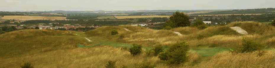
The five knolls, dunstable downs, Central Bedfordshire
KDK Archaeology carried out a programme of archaeological works at Five Knolls, Dunstable Downs, Central Bedfordshire, during the repair of erosion scars to the burial mounds. Prior to the commencement of the repair work, a topographical survey was carried out to record the landscape in general, and more specifically to identify the extent of the erosion to the mounds.
For the repairs, the scars were squared off to provide a stable edge to support the chalk and topsoil infill, though the minimum amount of material was removed in order to achieve this. The preparation of the scars revealed that relatively little damage had occurred to the body of the mounds, and that some previous 20th century repairs had endured fairly well. The extent of previous excavations was apparent in some of the barrows, as the material that apparently formed the substantive body of the barrows was a mixture of nodular chalk and topsoil.
-
The priory wall, dunstable, Central bedfordshire
-
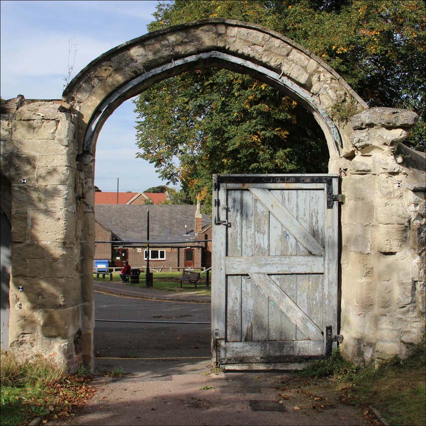
The medieval town of Dunstable was established by Henry I as a royal borough with a royal residence c.1108 and was closely followed by the foundation of a school and the priory. Of the priory only some of the original church, the building now known as Priory House and the gateway and associated wall have survived. A building recording programme was undertaken of the gateway and wall in 2013 in order to better understand its structural history. The wall, like the other priory buildings, had originally been built of locally derived Totternhoe clunch with little remaining other than the gateway by the early 18th century.
The evidence from the building fabric suggests the wall was rebuilt in the mid-late 19th century using the remaining Totternhoe Stone, limestone predominantly from Weldon and Clipsham, flint and -used brick. Later repairs and rebuilding programmes were evident in the use of Bathstone, cement based mortars and a range of brick types from the late 19th century onwards. Further investigations may also help to clarify how the gatehouse functioned; whether as a school, prison or simple porter’s lodge.
-
-
St Chad's, Woburn Road, marston moretaine, Central bedfordshire
-
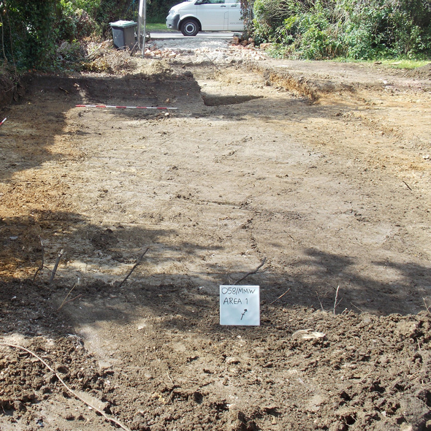
KDK Archaeology Ltd undertook an evaluation at St Chad’s, 1 Woburn Road, Marston Moretaine, Central Bedfordshire. As significant archaeology was present an immediate second stage, open area excavation was required within the footprint of the proposed development. Two boundary ditches, one almost 4m wide, and several pits were recorded. Pottery was recovered from most features and indicated that activity on the site was relatively short-lived between the early to mid-12th century to the early to mid-13th century.
The site lies adjacent to a medieval moated site of uncertain date, though is thought to have been replaced in the 14th century by Moreteyne Manor, another moated site immediately north of St Chads.
-
-
BLOORS PLACE, RAINHAM, KENT
-
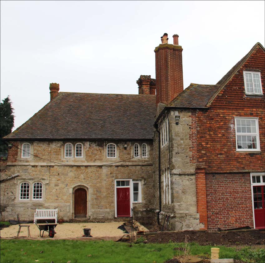
Bloors Place was the subject of historic building appraisal undertaken at the request of the owners. It is a late 15th century Wealden hall house with a stone range added to the rear in the early 16th century, probably by Christopher Bloor, whose reputation as a ghost is widespread in the locality. The house came indirectly into the ownership of the Earls of Thanet through Bloor’s daughter, Olympia, who was the first wife of John Tufton, father of the first Earl of Thanet. Bloors Place was reduced in both size and status to a farmhouse in later years, losing some of the east end of the north range and the southern end of the stone range by c.1800. Despite 18th and 19th century alterations, the interior of the building retains many early features and delightful wall paintings of fairy tale scenes from the 1950s in one of the bedrooms.
-
-
for further help and advice contacT Karin kaye MCIfA:
- Telephone: 01525 385443
- Email: office@kdkarchaeology.co.uk
Go to the top